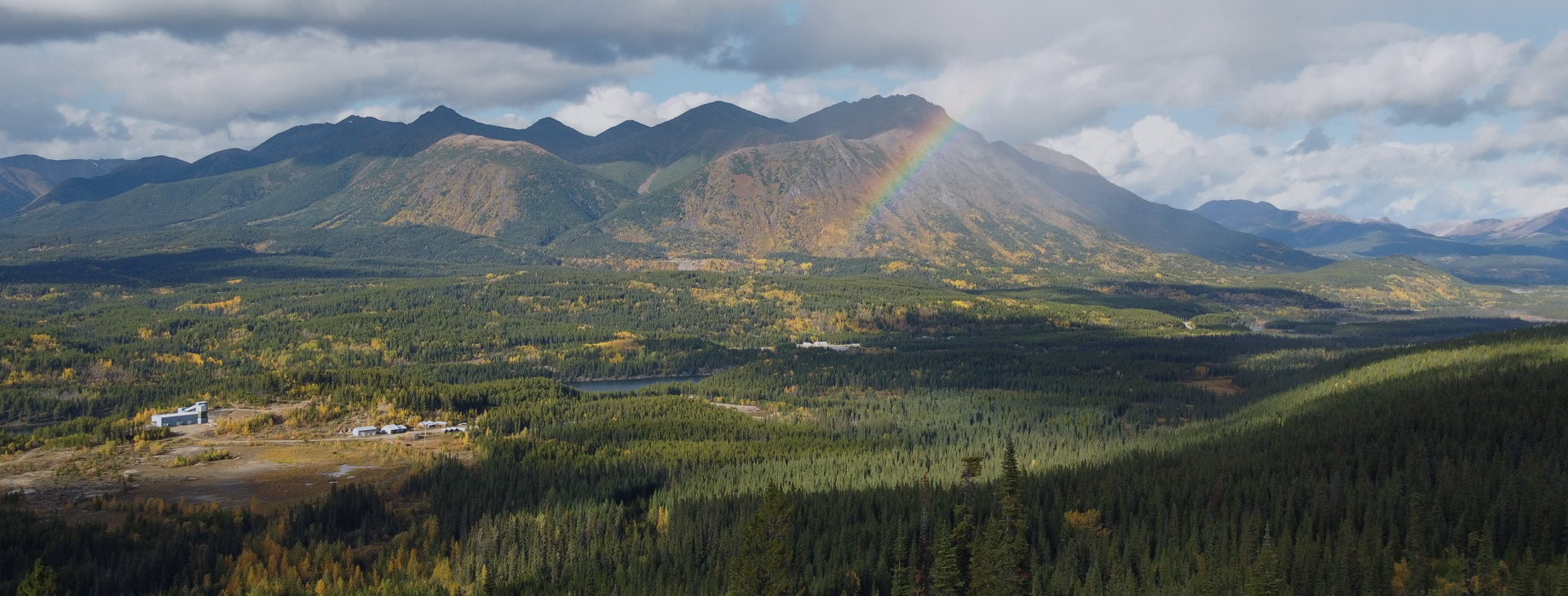
SHEEP CREEK CAMP
Covering an area of 3,939 hectares, the Sheep Creek Camp is highly prospective for both gold and silver discoveries and ranks as the third largest past-producing orogenic gold district in B.C. (behind Barkerville and Bralorne) with historical gold production of approximately 742,000 oz at an average grade of 14.7 g/t.1
A 2017 Geoscience BC Report (Allan, M.M., Rhys, D.A. and Hart Geoscience BC Report 2017-15) has shown that veining at Sheep Creek is analogous to that in the Barkerville area. In contrast to Barkerville, the Sheep Creek Gold District has had minimal modern exploration since mining ceased in the early 1950s.
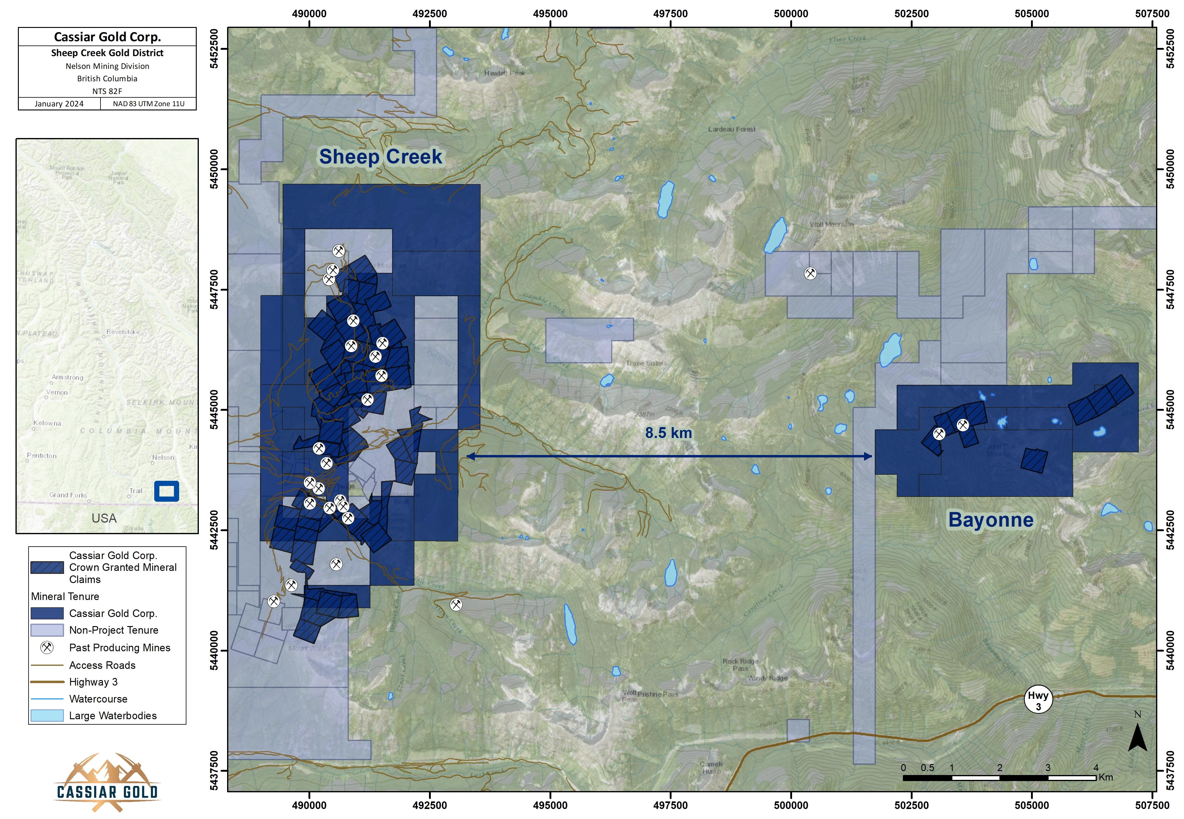
OWNERSHIP, SIZE & LOCATION
Cassiar Gold holds a 100% interest in properties covering most of the Sheep Creek gold camp located near Salmo, BC.
The Sheep Creek Camp consists of 79 crown grants and 31 mineral tenures totaling 3,939 hectares in the Nelson mining division. The Bayonne and Sheep Creek properties are located approximately 42 km and 12 km, respectively, east of Salmo, B.C.
BACKGROUND
Gold-bearing quartz veins were first discovered in the Sheep Creek area in 1896 and led to staking of the initial claims to cover the Yellowstone and Queen veins. Limited production in the Sheep Creek camp began in 1900 with the development of the Yellowstone mine, followed by the development of the Queen mine. Additional discoveries of auriferous veins were made in 1904-1905 and led to the development of the Kootenay Belle, Nugget and Motherlode mines by 1911. The Reno vein, discovered in 1912, was the last significant discovery made in the Sheep Creek gold camp, but became its most productive mine.
Since the early days of discovery, surface work and an estimated 65 km of underground development has identified approximately 60 to 70 veins over a roughly 8-km north-south trend. Total production from the Sheep Creek gold camp from 1900 to 1951 was approximately 742,000 ounces of gold, 365,000 ounces of silver, 377,000 lbs of lead and 312,000 lbs of zinc from 1.72 Mt of ore1. Total production from the mines that comprise the Company’s Sheep Creek Project (including Motherlode, Bluestone, Reno, Nugget, Gold Belt and Queen/Sheep Creek) is approximately 623,140 ounces of gold and 321,000 ounces of silver, or about 84% of the camp’s total gold production1. In contrast to Barkerville and Bralorne, the Sheep Creek gold district has seen little exploration since mining ceased in the early 1950s.
RECENT EXPLORATION
Margaux Resources optioned the Sheep Creek gold district in 2017 and exploration work that followed included the compilation and digitization of historical data, a prospecting and rock sampling program that returned samples grading between 17.8 g/t to 71.5 g/t Au, a LIDAR (light detection and ranging) survey, the application for multi-year area-based drill permits (see Margaux Resources news from January 6, 2017; February 8, 2017; September 11, 2017; December 12, 2017). Margaux Resources commissioned an independent National Instrument 43-101 report in 20171 and undertook a 19-hole drill program (4,039 m), which concluded in mid-December 2017 with limited drill success. However, further geological evaluation of the drill campaign indicates that additional exploration is highly warranted to better target the vein systems.
GEOLOGY & MINERALIZATION
The Sheep Creek area is underlain by a thick sequence of Lower Cambrian and Upper Proterozoic argillite, quartzite, limestone and schists belonging to the Quartzite Range, Reno and Laib Formations. Two north-trending anticlines are the dominant structures in the area. Gold veins in the Sheep Creek camp occur preferentially in bedded sequences of quartzite and phyllitic quartzite of the Reno and Quartzite Range Formations of the Lower Cambrian Hamill Group. The most productive gold veins were steeply south-dipping quartz veins containing pyrite, pyrrhotite and base metal sulphides that occupy ENE-trending fault-fracture zones with dextral strike-slip displacement.
Although there are gaps in the distribution of the veins, they are mostly regularly spaced on a frequency of approximately 100 to 200 m within a 1.2-km-wide, 7-km-long north-northeast trending corridor that coincides with the Western anticline and the west limb of the Sheep Creek anticline. Veins are preferentially developed in competent units in the folded sedimentary sequence, and only outcropping or near-surface veins have been historically mined.
EXPLORATION POTENTIAL
Like the Cassiar Gold district, in addition to extensions of known veins and additional parallel veins, the Company believes there is untested potential for unexposed stacked veins at Sheep Creek where additional, competent folded units lie below the areas of historical mining, especially in anticlinal hinges.
1 August 17, 2017, NI43-101 Technical Report on the Sheep Creek Project authored by Robert A. Lane, MSc, P.Geo.